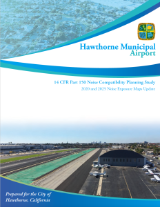
The City of Hawthorne has prepared a voluntary Noise Exposure Map update in accordance with Title 14 of the Code of Federal Regulations, Part 150 (14 CFR Part 150) for Hawthorne Municipal Airport. The study was a cooperative effort between the City and the Federal Aviation Administration (FAA). This Noise Exposure Map update, which was funded through Airport funds and by a grant from the FAA, was designed to update noise exposure maps originally published in 2013 in conjunction with a 14 CFR Part 150 Study initiated in 2011 for the airport. It is important to understand what this study did and did not do:
A Noise Exposure Map Update:
- Identifies the current and projected annualized aircraft noise levels at Hawthorne Municipal Airport using the Community Equivalent Noise Level (CNEL) noise metric.
- Identifies impacts on noise-sensitive land uses in the airport environs.
A Noise Exposure Map Update does not:
- Evaluate strategies to reduce the noise impacts above 65 CNEL from aircraft operating to and from Hawthorne Municipal Airport.
- Encourage future land uses which are compatible with aircraft noise, such as commercial or industrial in undeveloped areas.
- Determine methods to reduce the adverse impacts of noise above 65 CNEL.
- Establishes procedures to implement, review, and update the program.
- Evaluate aircraft operations from other area airports.
- Consider other types of impacts (air quality, accidents, etc.).
- Use noise metrics other than CNEL to determine noise impacts.
- Provide justification for airport expansion.
This website hosts project-related materials for review. Simply click a link or image below to view the corresponding PDF file.
Appendices


